Today, I ran the Emerald Bay Marathon, which is the first
race of the Tahoe Triple. The course is
point-to-point, starting at Emerald Bay, running around the south end of Lake
Tahoe, and finishing near Spooner Lake.
The elevation profile is U-shaped.
The early miles are sharply downhill, the middle miles are mostly flat,
and it ends with a long steep climb.
The race started at 7:00, but I had to get up much earlier,
so I could be ready to catch a bus at 5:30.
I bought groceries yesterday, so I was able to eat a light breakfast in
my room before leaving to catch the bus.
The buses left from a transportation center that’s across the street
from my hotel.
The buses dropped us off at Inspiration Point, which is a
scenic overlook on the south side of Emerald Bay. Usually, it’s cold at the start of the race,
but this year it was surprisingly comfortable.
The overnight low in South Lake Tahoe was 44 degrees. It’s usually colder at Inspiration Point, but
it didn’t feel too bad. There was a
truck to transport gear bags from the start to the finish, so I was able to
wear warm clothes until the race started.

This is a lightly supported race. Instead of having aid stations every mile or
two, you need to carry a bottle. Some
runners have crews, but you don’t really need one. Every four miles or so, there’s an aid
station where you can refill your bottle.
I wore a belt that holds one 22 oz. bottle.
In past years, I found the early miles to be the most
difficult. I was never good at running
downhill, and the first three miles descend 500 feet. I always beat up my quads in those first
three miles, leaving me sore for the rest of the weekend. This year, I was better prepared. Last month, I ran the Rockies Marathon
comfortably, even though it had a similar grade for the entire race.
The race starts on a road that has views on both sides. On my right, I had this view of another
alpine lake.

On my left, I had these views of Emerald Bay.


We quickly began to descend around steep turns like these.


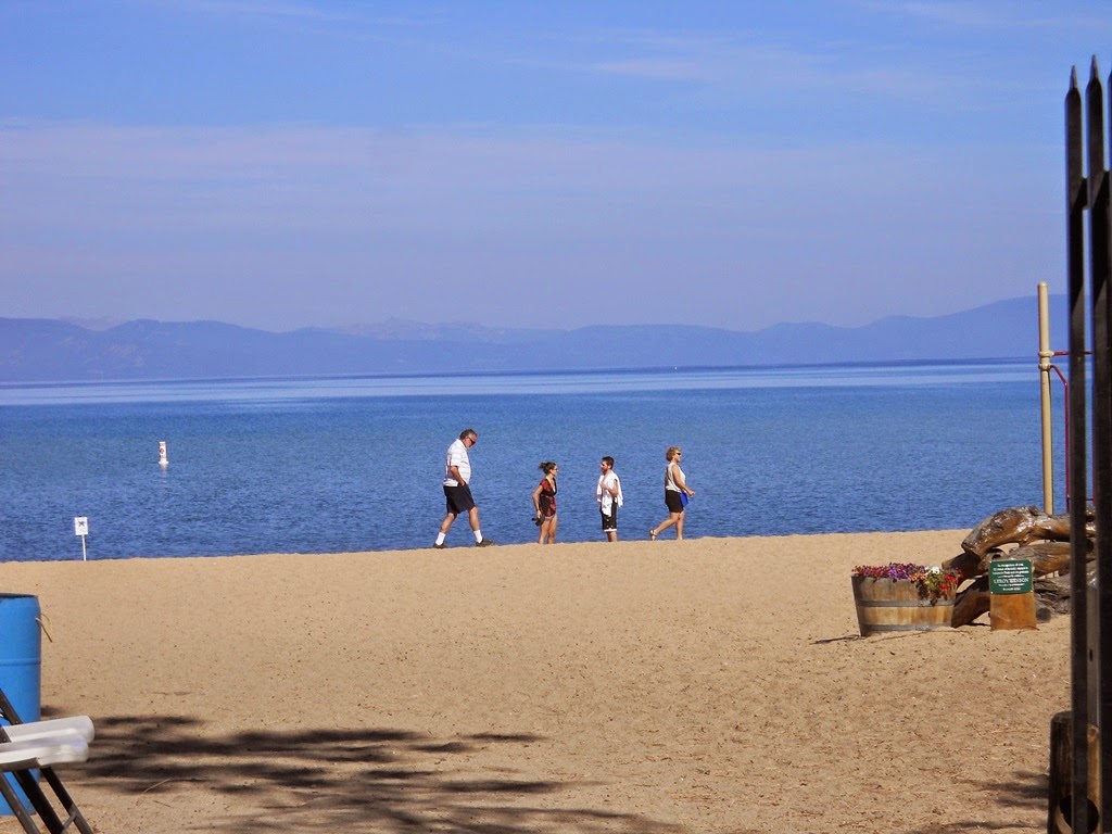
As we reached the third turn, we got out first glimpse of
the beaches on South Lake Tahoe.

Mile markers are only at multiples of five miles, so I wore
a Garmin watch. In the early and middle
miles, I wanted to know my pace. Late in
the race, I wanted to know what pace I would need to break four hours. In my two previous attempts, I ran this race
in 3:56 and 4:06. The late miles can be
incredibly slow.
Unlike past years, I ran the downhill miles with
confidence. My one mile split was
6:35. This picture shows a road way
below us. That’s the same road we were
on, after only one turn.

After about two miles, we had more views of the lake.


My second and third miles weren’t as fast as the first one,
but they were still fast. I ran the
first three miles about two minutes faster than I did last year.
As the road began to level out, we moved to this bike path,
which we would follow into South Lake Tahoe.

The next 10 miles were fairly flat, and my mile times ranged
between 8:00 and 8:30. For the entire
race, I was hoping to average about nine minutes per mile, but the second half
would be much more difficult. In
particular, the last few miles are so difficult, that I had never run them
without having to take walking breaks.
There were a few changes to the course this year. In the past, we ran through town on the edge
of highways 89 and 50. This year, to
avoid the traffic, we were rerouted on residential streets and bike paths. For a few miles, I didn’t know where I was, and
I had to watch carefully to keep from missing a turn. It’s a small race, so it doesn’t take long to
get separated from other runners.
When I reached the 10 mile sign, I noticed that my Garmin
was off by about a third of a mile. It
was still helpful for knowing my pace, but I realized I wouldn’t be able to
rely on it to know exactly how much was left in the late miles.
Just before the halfway mark, we turned left and ran down to
Lakeside Beach. The half marathon
finished here.

Those of us doing the marathon continued and turned onto Stateline
Avenue, which is on the boundary between California and Nevada.

As we returned to Highway 50, the road became more
rolling. At first, we had a few small
hills, and I was able to keep my mile times between eight and nine
minutes. As we got farther out of town, the
hills got bigger, and I began to tire noticeably. My next few mile times were between nine and
ten minutes. I had a big cushion, but it
was beginning to erode.
We were running on a narrow shoulder on the edge of a busy
highway. There were a number of sharp
turns, and cars were going by at fast speeds.
This part of the course always makes me nervous. Finally, at 20 miles, I spotted Cave Tunnel.
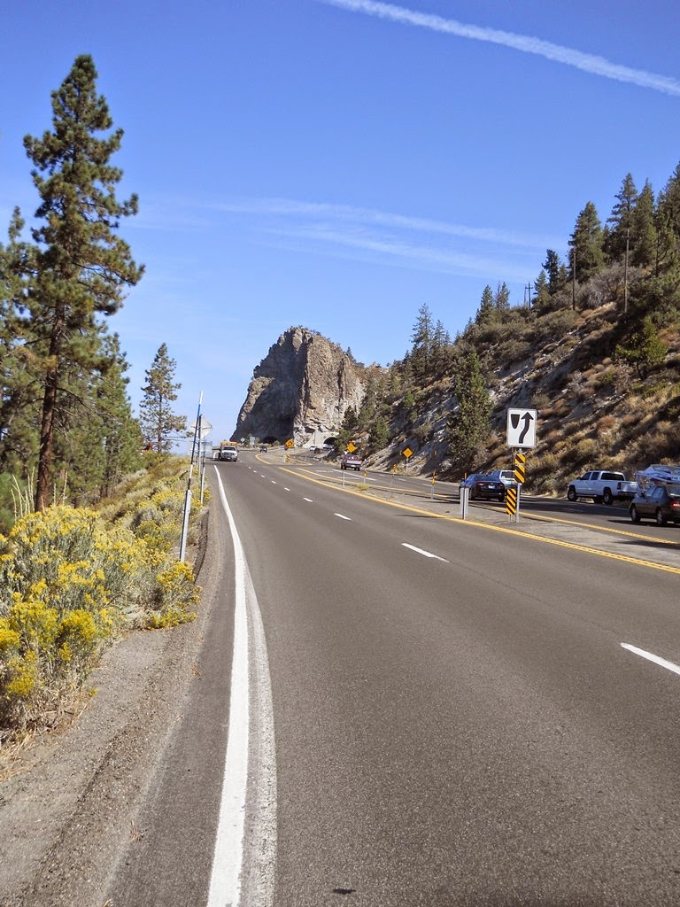

The tunnel has no shoulder, so a lane is blocked off for
us. More importantly, we continue to
have a lane of our own for the last six miles.
These miles are mostly uphill, but it was a huge relief to be out of the
traffic.
With about three miles to go, the road turns to the right
and begins climbing away from the lake.
I didn’t know the exact distance, and my watch wasn’t much help. I never saw the 15 or 20 mile signs, so I
didn’t know much my watch deviated from the official distance. I had about 36 minutes to break four hours,
but I was afraid I might have as much as three and a half miles to go.
I ran the best pace I could, knowing I was slowing down. I had a split of 9:50 for a mostly uphill mile. Then I had a 10:50 split for an all uphill mile. That was actually encouraging, but the road
kept getting steeper. I reached an
overlook where I had stopped on Wednesday.
This view of the lake shows how much I had already climbed.

I didn’t know how much farther I had to go. My watch read 3:40, giving me 20 minutes, but
I was worried I might have as much as two miles to go. I started seeing cars turning left and
disappearing behind the trees. I knew
the road had a broad bend to the left near the end of the climb. I was encouraged when I recognized this
hillside.

Later, I was relieved to see this sign. I had only half a mile to the turnoff for
highway 28. That’s the end of the long
climb, and I would only have about a quarter mile to go after that.

I still had about 13 minutes to break four hours. The hill was steepest here, but not for much
longer. I knew I would break four
hours. I had a shot at a course PR. As the road leveled out, I kept running hard. I turned left into the parking area where we
finished and then turned right to see the finish line. I finished in 3:55:18, setting a course PR by
more than a minute. I won’t know until
tomorrow if the course beat up my legs, but I felt OK when I finished.
Until last year, runners were on their own to arrange rides
back to South Lake Tahoe after the first two races. Now you can buy tickets for a shuttle. Because only a few runners finished ahead of
me, I had to wait about 45 minutes for the first shuttle. While I waited, I had a few snacks and
beverages. I also learned that I was
first place in the Masters division. The
overall winners and the Masters winners each got awards like this one.

After getting back to the hotel, I refueled with food I
bought on Wednesday and followed my usual recovery regimen for racing on
consecutive days. I feel OK now, but I’ll
probably be a little bit stiff tomorrow.
Tomorrow’s race is the Cal-Neva Marathon. On paper, it’s the easiest of the three, but
I’ve never run it faster than 4:25.
Hopefully this year, I won’t be as banged up at the start.
One down. Two to go.

No comments:
Post a Comment